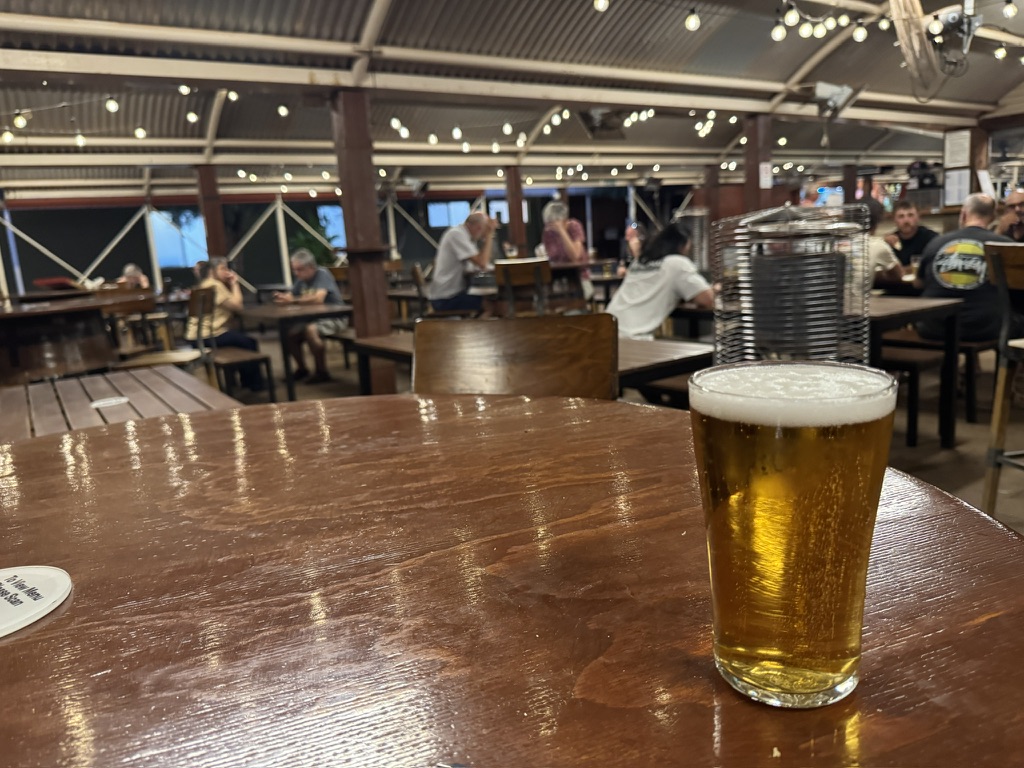
The View From My Beer
My only pit stop today on the drive from Alice Springs was at Curtis Springs for a schooner of Great Northern Super Crisp. Like a lot of outback pubs, there is no beer on tap, just the choice between a (hopefully) cold can or stubby.
Kata Tjuṯa
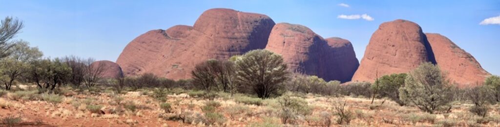
Today was going to be all about visits to big red rocks. The first of thos destinations was Kata Tjuṯa aka The Olgas. The Aboriginal name Kata Tjuṯa translates to “many heads,” an apt description for the 36 individual domed rock formations that make up Kita Tjuta. The tallest dome, Mount Olga, rises approximately 546 meters above the surrounding plain, making it about 200 meters higher than nearby Uluru.
While Uluru is made of arkose sandstone, Kata Tjuṯa is composed of a coarse-grained conglomerate rock, a mix of cobbles and boulders of varying rock types (including granite and basalt) cemented together by sand. The domes are estimated to be over 500 million years old, with their current shape a result of millions of years of erosion after being pushed up from an ancient seabed.
The site is incredibly sacred to the Aṉangu people. Legends include stories of the great snake king Wanambi, who is said to live on top of Mount Olga and whose breath could turn a breeze into a storm to punish those who did wrong.
Uluru
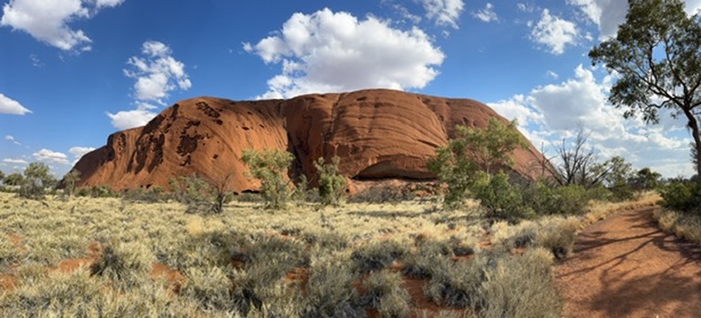
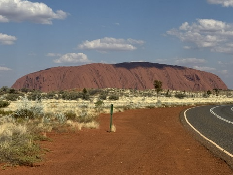
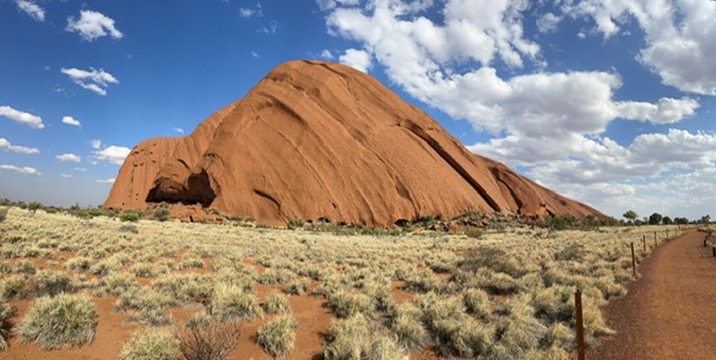
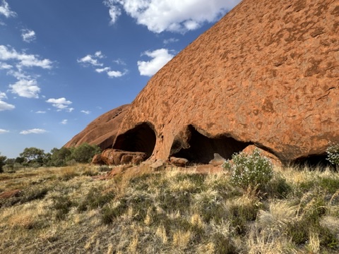
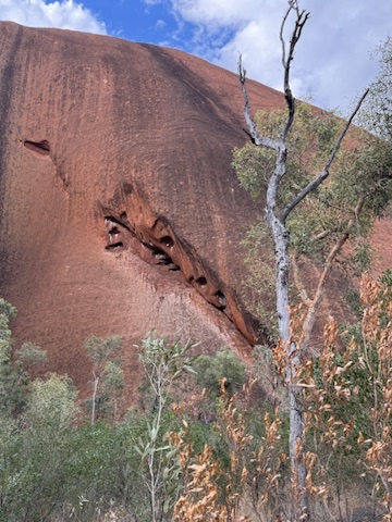
The second destination is arguably Australia’s best known icon alongside the Sydney Opera House, Sydney Harbor Bridge, and koalas. Uluru (aka Ayer’s Rock) is an ancient, underground sandstone monolith that’s about 600 million years old and appears to change color at different times of the day. It has a cultural and natural World Heritage listing, is sacred to the local Aboriginal Anangu people who own it.
The rock is 348 meters tall, taller than the Eiffel Tower, but the vast majority of its mass is underground. It’s estimated that over 2.5 kilometers of Uluru lies beneath the ground, making it resemble an iceberg.
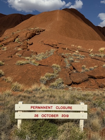
Climbing Uluru has been prohibited since 2019 to respect its cultural importance. I have had the good fortune of climbing Uluru twice. The clsic joke always being that there was a coke machine to be found at the top.
My Walk
Two walks today. A 3km walk at Kata Tjuta along the Waḻpa Gorge walk and a much longer 11km walk around the outside of Uluru.
Kata Tjuṯa
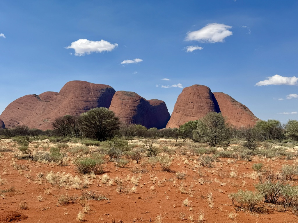
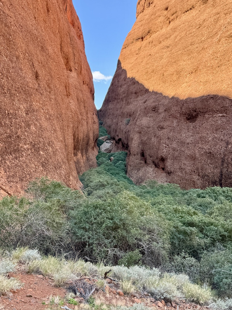
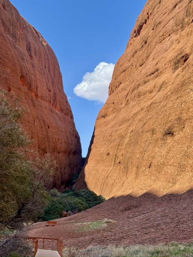
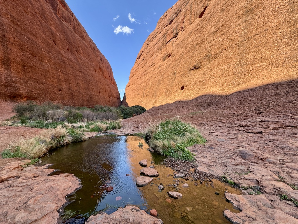
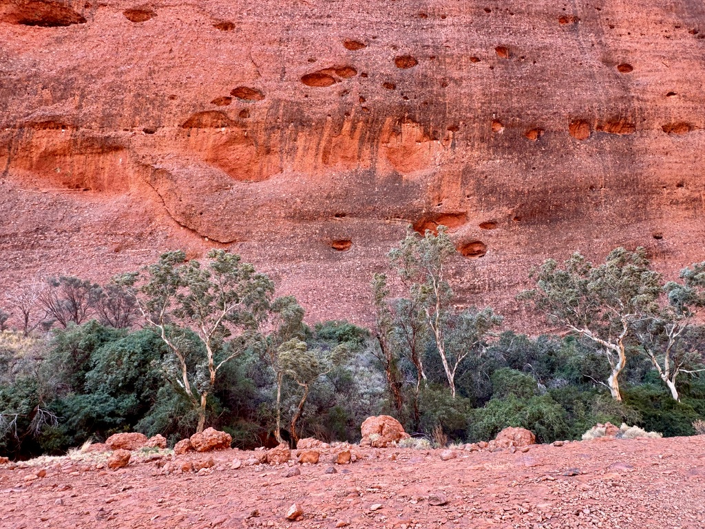
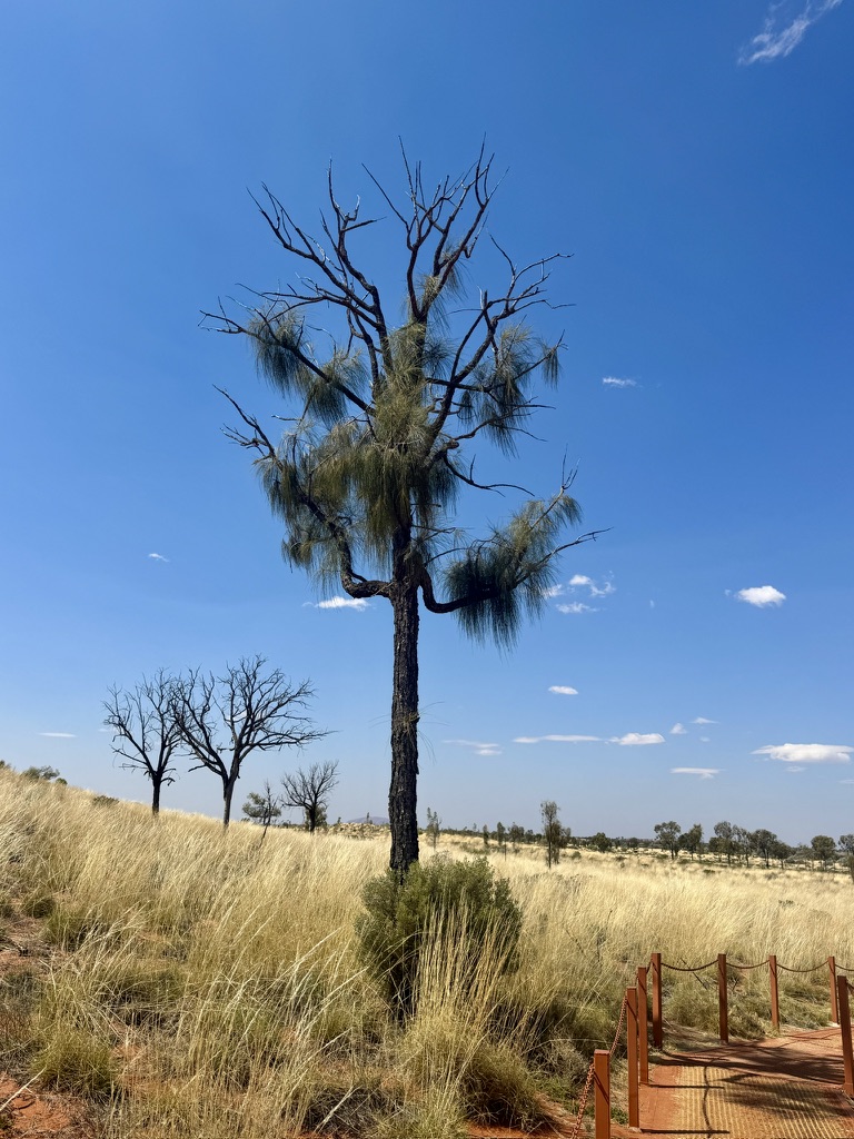
After making the 450km drive from Alice Springs to Yulara, I decided time was important and headed directly to Kata Tjuta. I didn’t have enough time to take the 8km Valley of the Winds Walk, but instead opted for the shorter, manageable, 3km Waḻpa Gorge walk. It was August, but the temperatures were in the mid 30s so I needed to be a little conservative with my timings. After spending five hours driving through flat barren nothing, it was fascinating to suddenly be walking through such a majestic landscape. All the more so because deep in the valleys between the domes there was lots of vegetation, and even ponds of water.
Uluru
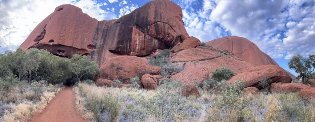
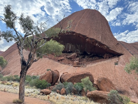
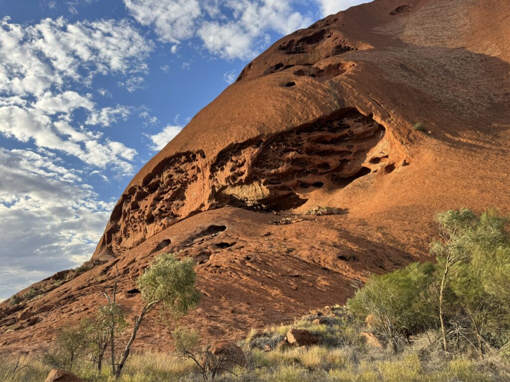
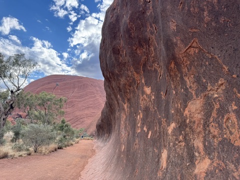
I decided to walk a circuit around the entire rock. BEing located near the geographic centre of Australia, there seemed to be some deep signifance in making a complte circuit around it. It took a while, but it allowed me to see Uluru from so many angles, many of which I had never seen before. We have all seen the classic profile of Uluru, but it takes on some very different shapes as you view it from differing angles.
Uluru at Sunset
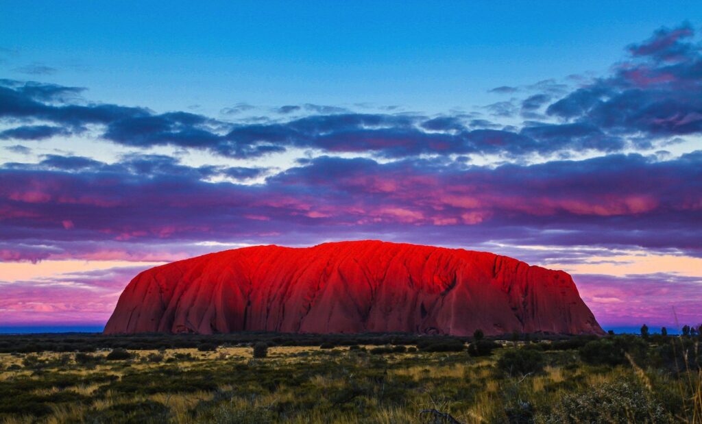
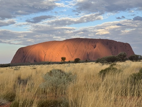
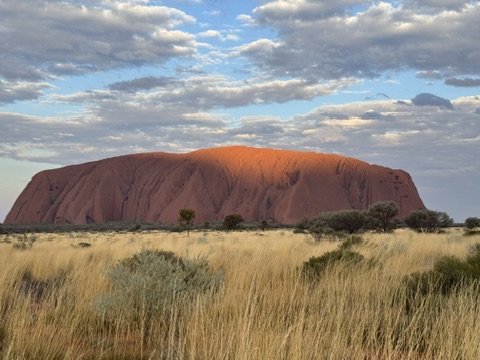
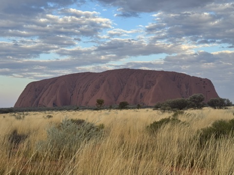
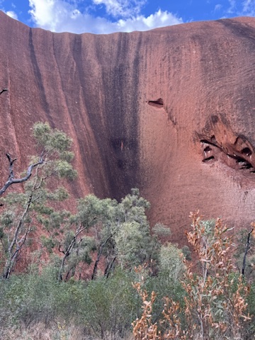
Uluru’s striking red color comes from the iron oxide in the sandstone and changes throughout the day due to the angle of the sun. These changes in color are more pronounced at sunrise and sunset, with special viewing areas devoted to viewing Uluru at these special times of the day. Even though I was looking forward to a nice cold beer after that long walk, I decided to hang around to view Uluru at sunset.